Lislea: Difference between revisions
No edit summary |
|||
| (6 intermediate revisions by the same user not shown) | |||
| Line 1: | Line 1: | ||
[[Category:Townland]][[Category:Manor of Knockballymore]] | [[Category:Townland]][[Category:Manor of Knockballymore]][[Category:Clankelly]][[Category:Galloon Parish]] | ||
{{Osmrelation|2105042}} | {{Osmrelation|2105042}} | ||
'''Lislea'' is a townland in South-Eastern [[wp:County Fermanagh|County Fermanagh]], [[wp:Northern Ireland|Northern Ireland]]. | |||
King William is supposed to have camped in the lawn of the big house here. 1690ish. He apparently planted a tree which still stands today? Try to get photograph and more info. is it an oak tree? Old man McCoy? | King William is supposed to have camped in the lawn of the big house here. 1690ish. He apparently planted a tree which still stands today? Try to get photograph and more info. is it an oak tree? Old man McCoy? | ||
==Etymology== | |||
* 1609 - Listormy - Esch. Co. Map, 6 | |||
* 1766 - Lislea - Reg Free Fer 8 | |||
* 1834 - Lios Liath "grey fort" - J O'D (OSNB) B141 | |||
* 2002 - Lios Liath "the grey fort" - HMC replies | |||
==Knockballymore Manor== | |||
During the Ulster Plantation 1610, a grant was made for 1,000 acres and named the [[Manor of Knockballymore]]. | |||
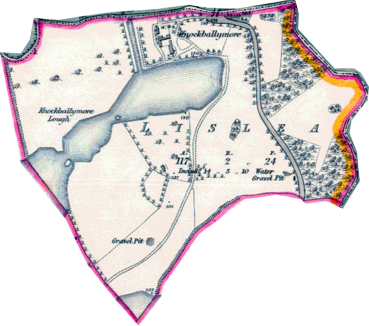
==1830's Map== | ==1830's Map== | ||
[[Image:Lislea1830's.png| | [[Image:Lislea1830's.png]] | ||
==Black Pig's Dyke== | |||
In a LiDAR model of the Lislea, a linear earthworks can be identified which is believed to be the remains of an ancient boundary called the [[Black Pig's Dyke]]. | |||
For more details, please see [http://www.longfordlibrary.ie/Heritage/Projects/Black-Pigs-Dyke/BPD_Phase_One_Report2014_vol1.pdf|The Black Pig's Dyke Regional Project Report - Page 51] | |||
Latest revision as of 22:25, 12 October 2019
| This townland has been mapped on OSM, click the following link to see : Lislea |
'Lislea is a townland in South-Eastern County Fermanagh, Northern Ireland.
King William is supposed to have camped in the lawn of the big house here. 1690ish. He apparently planted a tree which still stands today? Try to get photograph and more info. is it an oak tree? Old man McCoy?
Etymology
- 1609 - Listormy - Esch. Co. Map, 6
- 1766 - Lislea - Reg Free Fer 8
- 1834 - Lios Liath "grey fort" - J O'D (OSNB) B141
- 2002 - Lios Liath "the grey fort" - HMC replies
Knockballymore Manor
During the Ulster Plantation 1610, a grant was made for 1,000 acres and named the Manor of Knockballymore.
1830's Map
Black Pig's Dyke
In a LiDAR model of the Lislea, a linear earthworks can be identified which is believed to be the remains of an ancient boundary called the Black Pig's Dyke.
For more details, please see Black Pig's Dyke Regional Project Report - Page 51
