Mullynavannoge: Difference between revisions
(Created page with "Category:TownlandCategory:Manor of Knockballymore A townland in Fermanagh") |
No edit summary |
||
| (One intermediate revision by the same user not shown) | |||
| Line 1: | Line 1: | ||
[[Category:Townland]][[Category:Manor of Knockballymore]] | [[Category:Townland]][[Category:Manor of Knockballymore]][[Category:Clankelly]][[Category:Galloon Parish]] | ||
{{Osmrelation|2105032}} | |||
'''Mullynavannoge''' is a townland in South-Eastern [[wp:County Fermanagh|County Fermanagh]], [[wp:Northern Ireland|Northern Ireland]]. | |||
==Etymology== | |||
* 1609 - Mullanournog - Esch. Co. Map, 6 | |||
* 1659 - Mullenevanhoe - Census 1659, 112 | |||
* 2002 - Mullach na bhFeannóg "hilltop of the scaldcrows" - HMC Replies | |||
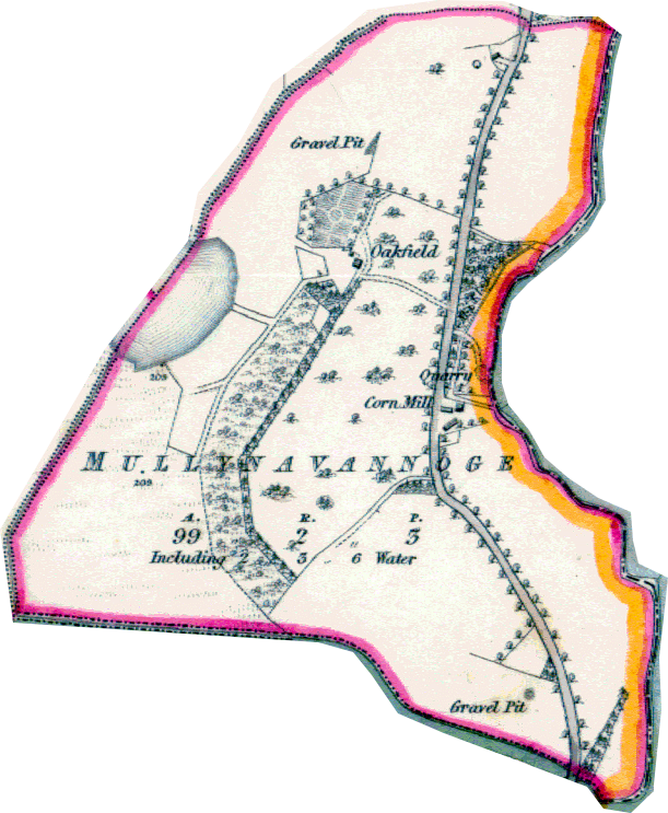
==1830's Map== | |||
[[Image:Mullynavannoge_1830's.png]] | |||
==Black Pig's Dyke== | |||
In a LiDAR model of the Mullynavannoge, a linear earthworks can be identified which is believed to be the remains of an ancient boundary called the [[Black Pig's Dyke]]. | |||
For more details, please see [http://www.longfordlibrary.ie/Heritage/Projects/Black-Pigs-Dyke/BPD_Phase_One_Report2014_vol1.pdf|The Black Pig's Dyke Regional Project Report - Page 51] | |||
Latest revision as of 23:30, 12 October 2019
| This townland has been mapped on OSM, click the following link to see : Mullynavannoge |
Mullynavannoge is a townland in South-Eastern County Fermanagh, Northern Ireland.
Etymology
- 1609 - Mullanournog - Esch. Co. Map, 6
- 1659 - Mullenevanhoe - Census 1659, 112
- 2002 - Mullach na bhFeannóg "hilltop of the scaldcrows" - HMC Replies
1830's Map
Black Pig's Dyke
In a LiDAR model of the Mullynavannoge, a linear earthworks can be identified which is believed to be the remains of an ancient boundary called the Black Pig's Dyke.
For more details, please see Black Pig's Dyke Regional Project Report - Page 51
