Baronie of Clancally (1609 Bodley Map): Difference between revisions
No edit summary |
No edit summary |
||
| Line 4: | Line 4: | ||
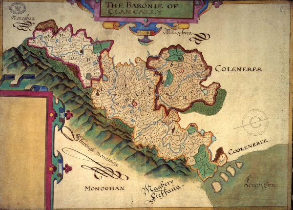
The following image is a map of Clankelly Barony. The map was produced in 1609 by Sir Josias Bodley to aid in the distribution of land in the Plantation of Ulster. | The following image is a map of Clankelly Barony. The map was produced in 1609 by Sir Josias Bodley to aid in the distribution of land in the Plantation of Ulster. | ||
[[File:Baronie of Clancally.jpg|thumb|600px|1609 Bodley Map of Clankelly (Click to Enlarge)]] | [[File:Baronie of Clancally.jpg|thumb|left|600px|1609 Bodley Map of Clankelly (Click to Enlarge)]] | ||
