Lislea: Difference between revisions
No edit summary |
No edit summary |
||
| Line 17: | Line 17: | ||
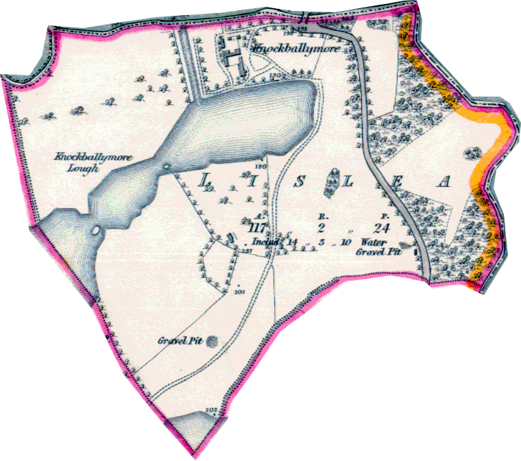
==1830's Map== | ==1830's Map== | ||
[[Image:Lislea1830's.png]] | [[Image:Lislea1830's.png]] | ||
==Black Pig's Dyke== | |||
In a LiDAR model of the Lislea a linear earthworks can be identified which is believed to be the remains of an ancient boundary called the Black Pig's Dyke. Please see [[http://www.longfordlibrary.ie/Heritage/Projects/Black-Pigs-Dyke/BPD_Phase_One_Report2014_vol1.pdf|The Black Pig's Dyke Regional Project Report - Page 51]] | |||
Revision as of 22:21, 12 October 2019
| This townland has been mapped on OSM, click the following link to see : Lislea |
'Lislea is a townland in South-Eastern County Fermanagh, Northern Ireland.
King William is supposed to have camped in the lawn of the big house here. 1690ish. He apparently planted a tree which still stands today? Try to get photograph and more info. is it an oak tree? Old man McCoy?
Etymology
- 1609 - Listormy - Esch. Co. Map, 6
- 1766 - Lislea - Reg Free Fer 8
- 1834 - Lios Liath "grey fort" - J O'D (OSNB) B141
- 2002 - Lios Liath "the grey fort" - HMC replies
Knockballymore Manor
During the Ulster Plantation 1610, a grant was made for 1,000 acres and named the Manor of Knockballymore.
1830's Map
Black Pig's Dyke
In a LiDAR model of the Lislea a linear earthworks can be identified which is believed to be the remains of an ancient boundary called the Black Pig's Dyke. Please see [Black Pig's Dyke Regional Project Report - Page 51]
