Lisnaskea: Difference between revisions
(Created page with ''''Lisnaskea''' ''(Lios na Scéithe - fort of the shield)'' is the second largest settlement in County Fermanagh, Northern Ireland. It had a population of 2,739 people in the 200…') |
No edit summary |
||
| Line 1: | Line 1: | ||
{{Infobox UK place | |||
|official_name=Lisnaskea | |||
|irish_name=Lios na Scéithe | |||
|scots_name= | |||
|local_name= | |||
|static_image= | |||
|static_image_caption= | |||
|map_type= Northern Ireland | |||
|latitude=54.25 | |||
|longitude=-7.442 | |||
|belfast_distance= | |||
|population = 2739 | |||
|population_ref = <small>([[United Kingdom Census 2001|2001 Census]]) | |||
|irish_grid_reference=H3634 | |||
|unitary_northern_ireland= [[Fermanagh District Council|Fermanagh]] | |||
|country= Northern Ireland | |||
|post_town= ENNISKILLEN | |||
|postcode_area= BT | |||
|postcode_district= BT92 | |||
|dial_code= 028 | |||
|constituency_westminster= [[Fermanagh and South Tyrone (UK Parliament constituency)|Fermanagh and South Tyrone]] | |||
|constituency_ni_assembly=[[Fermanagh and South Tyrone (Assembly constituency)|Fermanagh and South Tyrone]] | |||
|lieutenancy_northern_ireland= [[County Fermanagh]] | |||
|hide_services= yes | |||
|website= | |||
}} | |||
'''Lisnaskea''' ''(Lios na Scéithe - fort of the shield)'' is the second largest settlement in County Fermanagh, Northern Ireland. It had a population of 2,739 people in the 2001 Census. The town is built around the long main street, which bends at almost 90 degrees along its course. | '''Lisnaskea''' ''(Lios na Scéithe - fort of the shield)'' is the second largest settlement in County Fermanagh, Northern Ireland. It had a population of 2,739 people in the 2001 Census. The town is built around the long main street, which bends at almost 90 degrees along its course. | ||
Revision as of 16:17, 9 January 2010
| Lisnaskea | |
| Irish: Lios na Scéithe | |
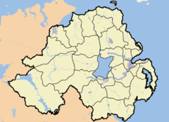
Lisnaskea shown within Northern Ireland | |
| Coordinates: 54°15′00″N 7°26′31″W / 54.25°N 7.442°W | |
| Population | 2,739 (2001 Census) |
|---|---|
| Irish grid reference | |
| District | Fermanagh |
| County | County Fermanagh |
| Constituent country | Northern Ireland |
| Sovereign state | United Kingdom |
| Post town | ENNISKILLEN |
| Postcode district | BT92 |
| Dialling code | 028 |
| European Parliament | Northern Ireland |
| UK Parliament | Fermanagh and South Tyrone |
| NI Assembly | Fermanagh and South Tyrone |
| List of places: UK • Northern Ireland • Fermanagh | |
Lisnaskea (Lios na Scéithe - fort of the shield) is the second largest settlement in County Fermanagh, Northern Ireland. It had a population of 2,739 people in the 2001 Census. The town is built around the long main street, which bends at almost 90 degrees along its course.
History
Lisnaskea has a proud heritage dating back to the ruling Maguire Clan of Fermanagh. It was once the Seat of the Clan, where Kings were crowned and ruled the County. This strategic importance led to the town changing hands many times over the years. Sir Michael Balfour took control of the town in the Plantation of Ulster and in 1821 it came under the control of the Earls of Erne. They established the market in the town whilst aiding and controlling development around the high street.[1]
Places of interest
Just off the Main Street are the ruins of Castle Balfour, built in 1618 by the Balfour’s. The castle was inhabited right up to the early 19th century and is currently undergoing a restoration programme.[2]
Education
Primary level
- St Eugene's Knocks Primary School
- The Moat Primary School
- St. Ronan's Primary School
Secondary level
- Lisnaskea High School
- St. Comhghall's Secondary School
2001 Census
Lisnaskea is classified as an intermediate settlement by the NI Statistics and Research Agency (NISRA) (ie with population between 2,250 and 4,500 people). On Census day (29 April 2001) there were 2,739 people living in Lisnaskea. Of these:
- 23.5% were aged under 16 years and 18.9% were aged 60 and over
- 46.8% of the population were male and 53.2% were female
- 74.1% were from a Catholic background and 24.5% were from a Protestant background
- 7.0% of people aged 16-74 were unemployed.
For more details see: NI Neighbourhood Information Service
Transport
- Lisnaskea railway station opened on 26 August 1858 and finally closed on 1 October 1957.[3]
References
- ↑ Culture Northern Ireland culturenorthernireland.org
- ↑ Enniskillen.com enniskillen.com
- ↑ "Lisnaskea station". Railscot - Irish Railways. http://www.railscot.co.uk/Ireland/Irish_railways.pdf. Retrieved 2007-10-28.
