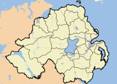
Killylackey
Killylackey is a townland in South-East County Fermanagh, Northern Ireland.
Area 96:3:28 including 16:0:38 water (Killyfole Lough)
Etymology
   * 1629 - (?)Killelackye
   * 1833 - Coill a Lagthaich "wood of the hollow"
   * 2004 - Coillidh Leacaigh "wood of the place of flagstones
The meaning of Killylackey is believed to mean (wood, flat stone or large stone)
On first hearing the meaning of the townland name, it was thought that it might be associated with stepping stones around the end of the Killyfole Lough. However, there could be another explanation. Not far from the lough shore, but at present covered by shrubbery and undergrowth, there was a well. This was topped with a very large flat stone and was thought to be of considerable age. It is believed that at one time there was an iron cup chained to this stone so that travellers could have a drink. We hope it will be possible to find this well when the lough shore trail work is underway.
Unfinished Lane
Until about 40 years ago, when it was cleared away, there had been a well made, wide laneway from the back of what was his uncle’s house along the back of the hill and coming almost to the road opposite Derek’s lane. This was clearly marked on the early map. It was dug out carefully with proper sheughs and with trees planted on each side and stoned part way. Work on it had never been finished and it had never been used. We knew from a church record that two Johnston families were in this townland in 1823. In the Public Records Office we found that a Francis Johnston of Aghadrumsee obtained a lease of 22ac.3 rood and 28 perch from Bernard Smith of Knockballymore in 1768. The lease was for the length of three lives which was a usual term in those days. The landlord and the person who was renting would agree three named people, very often family members or people of standing in the community and the lease would last until the last one died. The landlord made it a condition of the lease that the tenant would build a lime and stone dwelling house on the property. This was a way many landlords took of improving their property at no expense to themselves and was quite common. There were other conditions to the lease compelling the tenant to grind his corn at the landlord’s mill and provide three clamps of turf, four bushels of oats and 4 pullets annually to the manor house. There was a fine imposed if he failed to fulfill any of these In this case and in other leases by the same landlord there was also a condition to plant an orchard of ‘good cyder apples’
The lease was renewed in 1795 so there was a family on this farm with a long lease ahead and agriculture in a prosperous state at this time. So perhaps they had planned to further beautify their house by the addition of a nice tree lined avenue overlooking the Lough. The uncompleted avenue is clearly shown on the 1835 OS map so it was well on its way to completion before the new main road, the present B36, was constructed. This was worked at during famine times and completed around 1848. No further work was ever done on the avenue and perhaps after the famine the family was not in a position to do so for by the time the map was revised in 1855, the avenue is less clearly marked.
By 1862, there was a Thomas Johnston with 39 acres and a house which may be plain to our eyes but together with the farm buildings which were valued at £4, it was much better than the average for the locality. There were two other houses in Killylackey townland. One was the house on the Trap Brae the story of which is in Killyfole Remembers. The site of the other house, close to the Lough shore is remembered as Early’s garden and still has a couple of apple trees. The occupier, William Early married a Kate Late.
Griffiths Valuation 1862
| Occupier | Lessor | Tenement |
|---|---|---|
| Thomas Johnston | Earl of Erne | House, Offices and Land |
| Andrew Campbell | Thomas Johnston | House & Garden |
| Joseph Johnston | Earl of Erne | House, Offices and Land |
1901 Census
| Head of family | Name of Landholder(if different) |
|---|---|
| William Murray | |
| Francis Johnston |
