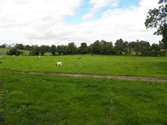
Drumyarkin
| This townland has been mapped on OSM, click the following link to see : Drumyarkin |
Drumyarkin is a townland in South-East County Fermanagh, Northern Ireland, a short distance West of the village of Roslea/Rosslea and close to the border of County Monaghan, in the Republic of Ireland.

Etymology
- 1887 -- "Yarkin's or O'Harkins ridge. O'Harkin = O'Dheargan [the red man]". Page 167, Studies in the Topology of Galloway, by Herbert Maxwell. David Doublas, Edinburgh.
- 1902 -- "O'Harkin's drum or hill-ridge." Page 137, The Origin and History of Irish Names of Places, Volume 2, by Patrick Weston Joyce. Longmans, Green, and Co. Dublin.
Tithe Applotment Books 1832
- The original records document the location as "Drumyarkin, Parish of Clones, Diocese of Clogher, County of Fermanagh, Manor of Slatmulroony".
- The National Archives of Ireland have the documents listed under County Monaghan due to the Civil Parish of Clones encompassing portions of both Counties Fermanagh and Monaghan.
| Land Holder's Names | Area (A-R-P*) | Rate Per Acre (s.d) | Yearly Tithe (£.s.d) | Additional Notes (Not in Original Records) |
|---|---|---|---|---|
| John Gordon | 14 - 0 - 27 | 1s.5d | £1.0s.1/2d | |
| Thomas Johnston | 2 - 1 - 8 | 1s.3d | £0.2s.10 1/2d | |
| James Beggin | 20 - 0 - 8 | 1s.5d | £1.8s.4 1/2d | Also occupied/farmed land in adjoining townland of Aghnashammer |
| George Maywood (?) | 6 - 0 - 20 | 1s.5d | £0.8s.8d | |
| James Johnston | 3 - 0 - 0 | 1s.3d | £0.3s.9d | |
| Robert Johnston | 2 - 1 - 8 | 1s.3d | £0.2s.10 1/2d | |
| TOWNLAND TOTALS | 47 - 3 - 31 | - | £3.6s.7d |
Area:
   A = Acre,  R = Rod (Rood),  P = Perch
   1 Acre = 4 Rods,  1 Rod  = 40 Square Perches
The National Archives of Ireland - Tithe Applotment Books - Drumyarkin
1841-61 Population
| Year | Persons |
|---|---|
| 1841 | 39 |
| 1851 | 27 |
| 1861 | 29 |
Griffiths Valuation 1862
Ask Ireland - Griffith Valuation - Drumyarkin
Census of 1901
The National Archives of Ireland - Census of 1901 - Drumyarkin
Census of 1911
The National Archives of Ireland - Census of 1911 - Drumyarkin