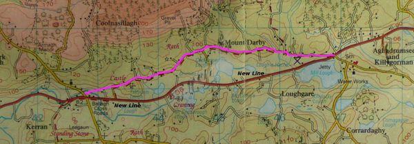
New Line
The new line was a road built during the great famine of Ireland (1840's). It was a project to provide food for the hungry in return for a days work. The new line is now known as the Dernawilt Road (B36).
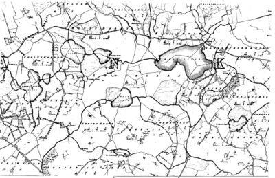
The path of the Old Road is shown in purple. The current B36 Dernawilt Road is marked as the "New Line" as many locals call it. The following map was drawn before the New Line was built and provides a great insight of what the local area would have looked like. With the Mount Darby road being the main transport route to Rosslea, it would have been very busy. Therefore, there were a number of shops, inns and resting places along this route.

